































How to Plan a Sailing Adventure Route
Planning a sailing adventure route requires more than drawing a line between two destinations. A reliable plan considers the boat, crew, route, weather, tides, currents, navigation hazards, fuel, water, daylight, regulations, and emergency alternatives. Current sailing guidance continues to emphasize that even short trips should involve some level of passage planning, with the amount of detail adjusted to the difficulty of the voyage. The process starts by understanding the boat’s draft, cruising speed, fuel and water capacity, equipment, and limitations, while also considering the crew’s experience and ability to handle long passages or night sailing. The route should then be divided into practical legs, with suitable harbours and anchorages identified along the way.

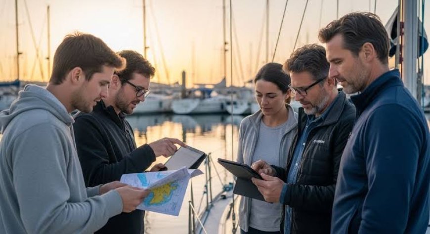

Planning a sailing adventure route is not simply a matter of choosing two points on a chart and drawing a line between them. A good route has to work with the boat, the crew, the weather, the sea state, navigation hazards, tides, currents, fuel and water capacity, port restrictions, and the amount of time available. The route that looks shortest on a chart may not be the safest or fastest route once wind, current, traffic and coastal conditions are considered. Modern chart plotters, satellite communications, digital charts and weather-routing services make planning easier, but they do not remove the need for practical judgment. Current passage-planning guidance from the Royal Yachting Association, for example, treats route, tides and currents, navigation dangers, constraints, refuge, daylight, weather and the boat's limitations as core parts of a passage plan.

The best approach is to build the route in stages. Start with the purpose of the trip, understand the boat and crew, study the sailing area, identify realistic stopping points, examine weather and currents, calculate the passage, check regulations and navigation warnings, prepare the boat, and then create alternatives in case conditions change. This process applies whether the adventure is a weekend coastal trip, a multi-day island passage or a longer offshore voyage. The difference is the depth of planning required.
Start With the Boat, Crew and Goal
Before opening a navigation app, define what you are actually trying to achieve. A sailing adventure can mean a two-day coastal cruise with overnight anchoring, a week-long trip between islands, or an offshore passage with several days at sea. Each type of trip creates different planning requirements. If the main purpose is exploring small anchorages, the route should leave enough time for short daily passages and flexible stops. If the objective is reaching a distant destination, passage speed, weather windows, fuel range and crew endurance become more important.
The boat should determine the limits of the route, not the other way around. Check the boat's cruising speed under engine and under sail, fuel capacity, fresh-water capacity, battery capacity, draft, air draft, displacement and comfortable operating conditions. Draft is especially important when planning routes through shallow bays, rivers, lagoons and poorly surveyed areas. Air draft matters when bridges, power lines or other overhead restrictions are present. A sailboat with a deep keel may be perfectly comfortable offshore but unsuitable for an anchorage that appears attractive on the chart.
Engine condition also deserves attention before the trip. An engine problem becomes much more serious when the boat is approaching a harbor in strong wind or when there is little room to maneuver. Check the cooling system, belts, fluids, filters, fuel supply, battery system and starting ability. Carry the tools and basic spare parts needed for problems that the crew can realistically repair. The RYA specifically identifies checking the engine before departure as part of practical passage preparation.
Crew capability is equally important. A route suitable for an experienced offshore crew may be inappropriate for a group that has only sailed during daylight in protected waters. Consider who can navigate, who can stand a night watch, who can reef sails, who understands VHF radio procedures and who can take over if the skipper becomes unavailable. Fatigue is a route-planning issue because a passage that is technically possible may still be a poor choice if the crew will arrive exhausted.
Once these limits are understood, define the trip's objective. Decide where you want to start, where you want to finish and what you want to do along the way. Then establish a realistic maximum passage length. It is better to plan a route that leaves room for weather delays than one that assumes every day will go exactly according to schedule.
Study the Sailing Area before Drawing the Route
Once the basic parameters are clear, study the entire sailing area rather than immediately focusing on the destination. Look at the coastline, islands, headlands, bays, channels, reefs, shoals, ports and possible emergency anchorages. The first route you draw should be considered a planning line rather than a final track.
Use official or properly licensed nautical charts appropriate for the area. Digital charts are extremely useful, but a sailor should understand what the chart actually represents and when its information was surveyed. Depth information, isolated dangers and navigation marks need particular attention. Do not assume that a large-scale overview chart contains enough detail for entering a small harbor or navigating close to rocks.
Mark the places where the route could become difficult. These might include narrow channels, strong tidal passages, exposed headlands, fishing grounds, commercial shipping lanes, shallow approaches, bridges, restricted zones or areas with limited shelter. These points are often called route constraints because they determine when and how the boat can safely pass.
A straight line between two harbours is rarely the complete answer. The RYA notes that a direct line from one point to another will seldom be possible because hazards, navigational risks and other constraints affect the intended route.
For a coastal adventure, divide the route into manageable legs. For example, instead of thinking about a 150-nautical-mile journey as one passage, identify three or four possible stages of 30 to 60 nautical miles. This gives the crew more options. If weather deteriorates, the boat can stop at an intermediate harbor. If the weather remains favorable, the crew can continue farther.
This approach also helps with provisioning. A route with reliable fuel docks, water supplies and grocery access requires less storage capacity than a route where the boat may remain away from services for several days.
Build the Route around Weather, Wind and Current
Weather should influence the route from the beginning rather than being checked immediately before departure. Wind direction can determine which side of an island is comfortable, whether a particular anchorage is protected and whether a coastal passage will involve prolonged beating into waves.
Do not look only at wind speed. Wind direction, gusts, wave height, wave period, visibility, thunderstorms, air pressure and fronts can all affect the passage. A forecast showing moderate wind may still produce uncomfortable conditions if the wind opposes a strong current and creates short, steep waves.
Currents can change a route significantly. If a current is flowing in the same direction as the boat's movement, it can increase speed over the ground. An opposing current can add hours to a passage. In narrow channels and around headlands, current can also affect maneuverability. Tidal predictions are therefore an important part of passage planning, particularly when the route includes shallow water or tidal gates.
A useful method is to calculate the route using both distance through the water and expected speed over the ground. Suppose a sailboat normally cruises at 6 knots through the water. A 30-nautical-mile leg would theoretically take five hours in still water. A 2-knot adverse current could reduce progress over the ground to roughly 4 knots, increasing the theoretical time to about 7.5 hours. Actual sailing time will vary because wind, waves, sail changes and maneuvering affect boat speed.
Weather routing can help compare possible tracks, particularly on longer passages. Modern systems can combine forecast wind, waves and currents with a boat's performance data. However, routing software should be treated as decision support rather than an automatic answer. Forecasts can change, model resolution can be limited in coastal areas, and a computer does not understand every practical consideration surrounding a harbor entrance or anchorage. Weather-routing guidance also stresses that technology does not eliminate the need for a navigator to understand and question the recommended route.
For a departure decision, examine several forecast updates rather than relying on a single forecast. Use longer-range forecasts to identify possible weather patterns, then make the final decision using the most recent marine forecast and observations available. Check conditions again before departure and continue monitoring them during the passage.
Plan Navigation Hazards and Safe Alternatives
After identifying the main weather pattern, work through the route for navigation hazards. This is where a rough route becomes a practical passage plan.
Check every significant turning point. Look at rocks, reefs, shoals, wrecks, prohibited areas and shallow water. Identify navigation marks and understand which side of each mark the boat should pass. Pay attention to charted depths and the boat's draft, allowing an appropriate safety margin rather than planning to pass with only a few centimeters of clearance.
Commercial traffic needs special attention around major ports, straits and traffic separation schemes. International collision regulations, known as COLREGs, establish rules intended to prevent collisions at sea, including provisions concerning traffic separation schemes. A sailing route that crosses a busy shipping area should therefore be planned with traffic patterns in mind rather than treating the area as open water.
Mark potential refuge points along the route. These might be marinas, fishing harbors, sheltered anchorages or safe bays. Do not simply mark them on the chart; determine whether they are actually usable. Check entrance depth, available shelter, prevailing wind direction, mooring arrangements, local restrictions and whether access is possible at night.
This is one of the most important differences between a route and a passage plan. A route tells you where you intend to go. A passage plan also considers what you will do when something goes wrong.
For example, if the forecast changes to strong winds from the northwest, where will you go? If the engine stops, what sheltered water is within reach? If someone becomes ill, which harbor has the shortest safe approach? If visibility falls, which parts of the route become unacceptable?
Create alternative routes before leaving. An alternative does not need to be as detailed as the primary route, but it should be realistic enough to use under pressure.
Calculate Time, Fuel, Water and Daylight
Time calculations should include more than the theoretical distance divided by boat speed. Add time for sail changes, navigation, traffic, anchoring, harbor approaches, tidal restrictions and possible reductions in speed caused by sea conditions.
Daylight is another major factor. A route that is easy to navigate at noon may be much more demanding at night, especially for crews unfamiliar with the area. If possible, schedule first-time harbor entrances during daylight. When a night arrival is unavoidable, study the lights, leading marks, buoys and approach beforehand.
Fuel planning should include a reserve. Do not calculate the amount of fuel needed by assuming the engine will operate continuously at its ideal consumption rate. Fuel consumption changes with engine load, sea conditions, fouling, propeller condition and boat speed. A reserve provides protection when the passage takes longer than expected.
Water planning deserves the same discipline. Calculate drinking water separately from water used for cooking, cleaning and other purposes. The amount required depends on crew size, temperature, trip duration and whether reliable resupply points exist.
Food should also be planned around delays. If the route takes three days, carry enough provisions for longer than three days. A weather delay is not an exceptional failure of the plan; it is a normal possibility in sailing.
Use Modern Navigation Technology Without Depending on It
Today's sailors have access to tools that previous generations could not use. Chartplotters can display electronic charts, GPS position, AIS traffic, depth information and route tracks. Smartphones and tablets can provide additional navigation and weather applications. Satellite communications can provide access to forecasts and emergency communication far from cellular networks.
These tools are useful, but redundancy remains important. Batteries fail, antennas fail, screens get wet, software crashes and electronic charts can be unavailable. A responsible passage plan should not depend on one device.
Before departure, make sure the crew understands how to use the primary navigation system. Check that charts cover the complete route and are updated as required. Make sure waypoints have been entered correctly and inspect the route at an appropriate chart scale. A waypoint accidentally placed on the wrong side of a reef can create a serious problem if the crew follows it without visually checking the surroundings.
Keep paper charts or another suitable independent navigation method when appropriate for the voyage and local requirements. The exact backup arrangement should reflect the boat, route and level of risk.
AIS can be particularly helpful around commercial traffic because it provides information about vessels equipped and operating with AIS, but it should not replace visual lookout or proper collision-avoidance procedures. Radar, if fitted, provides another source of information, especially at night or in reduced visibility.
Weather information should come from reliable marine sources. Maritime safety information can include both weather information and navigational warnings, and such information may be broadcast through marine communication systems.
Check Rules, Permissions and Local Restrictions
A sailing route can be technically safe and still be impractical because of regulations. Before departure, check the requirements that apply to the boat and the waters being visited.
Depending on the voyage, these can include registration documents, insurance requirements, crew identification, customs and immigration procedures, port-entry rules, cruising permits, protected-area restrictions, fishing restrictions, anchoring regulations and local environmental rules.
Safety-equipment requirements vary by country, vessel type, size and operating area. Do not assume that equipment required in your home waters automatically satisfies the rules somewhere else. The same principle applies to radio licensing and operator qualifications.
International requirements also continue to develop. The International Maritime Organization reported that several amendments to maritime treaties and codes entered into force on 1 January 2026, demonstrating why sailors planning international or regulated voyages should check current requirements rather than relying on old checklists.
For ordinary recreational sailing, the precise legal obligations depend heavily on jurisdiction, so local maritime authorities should be treated as the final source for requirements. Where the route crosses international borders, plan customs and immigration stops rather than assuming that a convenient anchorage is an acceptable entry point.
Prepare the Boat and Crew for the Route
The route should determine the final preparation list. Before leaving, inspect rigging, sails, sheets, halyards, steering, anchor equipment, bilge systems, electrical systems, navigation equipment, communications and engine systems. Secure loose equipment inside the cabin and on deck.
Safety equipment should match the voyage rather than merely meeting the minimum legal requirement. Consider lifejackets and harnesses, lights, signalling equipment, first-aid supplies, fire extinguishers, emergency communications and appropriate means of recovering a person from the water. For offshore passages, additional equipment may be appropriate depending on the boat and route.
The crew should know where the safety equipment is stored and how it works. A life raft that nobody knows how to deploy is not a complete safety plan. The same applies to the VHF radio, emergency position-indicating equipment, navigation equipment and engine controls.
Conduct a briefing before departure. Explain the route, expected weather, watch arrangements, navigation hazards, emergency procedures and communications plan. Everyone should know what to do if someone falls overboard, the boat takes on water, the engine fails or the skipper becomes incapacitated.
It is also sensible to tell someone ashore about the planned route and expected return. The RYA recommends informing a responsible person where you are going and when you expect to return, with suitable means of communication depending on the type of boating.
Turn the Route Into a Practical Passage Plan
Once all the information has been collected, write the plan down. The final document does not need to be complicated. It should show the intended departure point, destination, waypoints, courses, distances, expected speeds, estimated times, hazards, tidal considerations, weather limits and alternative options.
A useful passage plan follows the actual sequence of the journey. Start with departure. Identify the safe exit from the marina, harbor or anchorage. Then consider each navigation leg in order. At every important point, know what you expect to see, what the depth should be and what hazards are nearby.
For example, a coastal passage might begin with a harbor exit, followed by a 12-nautical-mile offshore leg, a headland crossing, a tidal channel and finally a harbor entrance. Each stage creates different considerations. The offshore leg may be mainly concerned with weather and traffic, while the tidal channel depends heavily on timing and water depth.
Do not make the plan so rigid that changing it feels like failure. Sailing is affected by conditions that cannot always be predicted accurately. If the wind changes, the crew becomes tired or the sea state becomes uncomfortable, changing the route is often the correct decision.
A strong passage plan therefore contains decision points. Before reaching a difficult section, establish the conditions under which you will continue and the conditions under which you will divert. This makes decision-making easier when the crew is tired or the weather is deteriorating.
Monitor the Route After Departure
Planning does not end when the anchor is raised. A sailing route is a living plan that should be reviewed throughout the voyage.
Compare actual position and speed with the original plan. Check the weather forecast regularly and look for changes in wind direction, pressure, waves, thunderstorms or visibility. Monitor navigation warnings and traffic conditions. If the boat is moving more slowly than expected, recalculate the estimated arrival time rather than continuing with an outdated schedule.
Watch the crew as closely as the weather. Fatigue can reduce concentration and make simple navigation tasks harder. If the crew is becoming exhausted, shorten the passage or stop somewhere safe.
The same principle applies to the boat. Unusual engine temperatures, steering problems, battery voltage changes, leaks, rigging noises or other abnormal signs should be treated as information about the condition of the vessel. A small problem discovered early is much easier to manage than the same problem several hours later offshore.
Weather routing systems can provide useful guidance, but the navigator remains responsible for deciding whether a route is appropriate. Even professional weather-routing information should be interpreted in the context of the boat's capabilities and the crew's experience.
Make the Adventure Flexible
The strongest sailing routes leave room for change. Do not measure success only by reaching the final destination. A well-planned adventure may involve changing the destination because the wind shifts, spending an extra night in a safe harbor or skipping an exposed anchorage.
Build spare days into longer trips whenever possible. A schedule with no spare time encourages crews to make poor decisions when weather delays occur. If a two-day weather system can force you to leave shelter before conditions improve, the original schedule was too tight.
Think of the route as a series of choices rather than a single line. At every stage, you should know where you are, where you can go next and what conditions would make you change direction.
This approach also makes sailing more enjoyable. When the crew is not under pressure to reach a destination at a fixed time, there is more freedom to explore an unexpected bay, stay longer at a good anchorage or wait for better conditions.
Planning does not remove the uncertainty that makes sailing different from driving. It gives the crew a way to manage that uncertainty.
What's Your Reaction?
 Like
0
Like
0
 Dislike
0
Dislike
0
 Love
0
Love
0
 Funny
0
Funny
0
 Angry
0
Angry
0
 Sad
0
Sad
0
 Wow
0
Wow
0